News

  • You are here:
  • Home
  • News

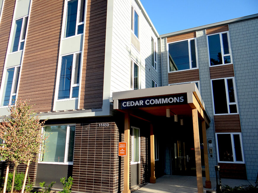
Emerio Helps Bring Division Street Housing Projects to Life

Driving east on SE Division Street past SE 112th Avenue in the Powellhurst-Gilbert neighborhood, you will find the Division Street Campus, three developments featuring several types of affordable and supportive housing. Built over several years, Cedar Commons, Crescent Court, and Meridian Gardens are now open and are providing individuals and...
Read More

Designing a Dream Home in NW Portland

Emerio’s house design, engineering, surveying, and permitting teams came together to bring one family’s long-held vision to life in Northwest Portland. The homeowners had always dreamed of creating a place where their children could grow up and where extended family would feel welcome. They loved their lot and its location,...
Read More

Dave Reece to Retire

After more than 42 years of working in civil engineering across the Pacific Northwest, David J Reece, PE has announced his retirement. A 1977 graduate of Oregon State University’s College of Engineering, Dave opened his own firm in 1997, bringing civil engineering design and project / construction management services to...
Read More

Emerio Launches New Survey Drone

Emerio’s survey capabilities now include the DJI Matrice 350 TRK 3D LiDAR Drone, allowing us to provide clients with the most accurate way of capturing 3D LiDAR data from the sky or on the ground! Our new drone technology is ideal for: Existing conditions for site development Topographic and basemapping...
Read More

Emerio Design Acquires Reece & associates

Two Titans Join Forces to Bring Expanded Civil Engineering Services to You! Since 2005, Emerio Design has been a thought leader in civil and structural engineering, land use planning, surveying, and house design across the Pacific Northwest. Today, we are thrilled to announce the expansion of our services into Oregon’s...
Read More

Join our Land Surveying team!

Considering a career in Land Surveying? Emerio Design is hiring! What does a Land Surveyor Do? Land Surveying is the practice of establishing the exact positions of boundaries and other features of a parcel of land. It involves measuring distances, angles, and elevations of points of reference, as well as...
Read More